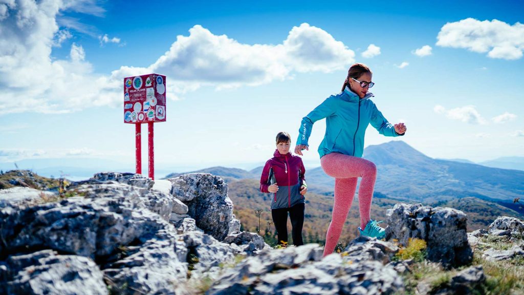
Trail 1: Poklon – Vojak 1.396 m
Duration: 1:30h
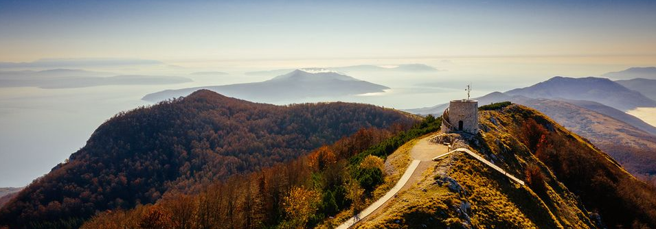
It takes approximately one and a half hours to climb from the Poklon pass (922 m) to the Vojak summit (1.396 m).
The panoramic view spot, a stone tower, offers a fantastic view of Istria and Kvarner. There are a small hotel, a mountain lodge and an Učka Nature Park info point on the Poklon pass.
The Poklon pass can be reached by car from Ičići (12 km). A bus line from Opatija operates on Sundays (line 34) departing from the Slatina bus station.
Trail 2: Lovran – Liganj – Vojak 1.396 m
Duration: 4:30h
The Tourist Office in Lovran marks the beginning of Rijeka hiking trail, which will lead you through the area called Brajdice and further west over the stone steps to the village Liganj.
At the signpost the trail turns right and leads through the hamlets Dindići and Ivulići, along Banjik, to Kaluža and further towards Oplovac until the crucifix. After the crucifix the trail continues left. This section is a nice winding climb up to the west and below the Grnjac peak (850 m) that leads to the area called Dol.
Across the Banina creek westward, the trail leads through meadows to the beech forest and meanders further to the pass Vrata.
From there the trail will lead you through Veli and Mali dol to the pass Sedlo where it abruptly turns right and continues along the steep ridge to the highest peak of Učka – Vojak (1,396 m). There is a stone lookout tower at the top built in 1911.
Trail 3: Medveja – Lovranska Draga – Mala Učka – Vojak 1.396 m
Duration: 5:30h
From the place of Medveja on the main road from Rijeka to Pula, 100 m before the entrance to the camp, marked forest road leads to the right alongside the camp. After travelling 400 meters to the west, the trail turns left to a stream, follows the stream and then starts uphill to meadows and vineyards below Lovranska Draga.
Beyond this village, the path climbs steeply uphill to the marked route leading from Laz to Mala Učka. The path turns to the left, gently climbing to the south-southwest through a forest to Babin grob. From Babin grob it continues through meadows and karst terrain, crossing a stream and fir forest, leading to an unpaved road for the village Mala Učka.
In the middle of the village is a marked path leading to the right and sharply uphill to the crest below the pass, following the crest to the saddle and from the marker leading sharply uphill to the peak of Vojak.
Trail 4: Mala Učka
This village is the highest rural settlement in Istria, located at an elevation of 995 metres above sea-level. It has retained the original rural architecture and was known for its production of sheep’s milk cheese. Today, there is only one family of sheep farmers left and the village is visited mostly by weekenders, vacationers and hikers.
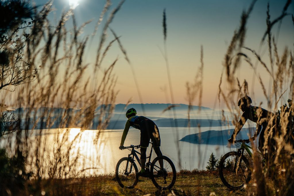
Trail 5: Mountain Bike
The bike trail begins in the Marović area above the village of Tuliševica. It is a forest road that first runs in the northern direction, then leads towards the Učka Tunnel, west towards the Grnjac summit (850 m), and further towards the village of Mala Učka.
From the village of Mala Učka the trail goes through a plateau and a pine forest to the village of Vela Učka, and further along an asphalted road to the Poklon pass (922 m). The trail is 27 km long and the difference in height is approximately 450 meters.